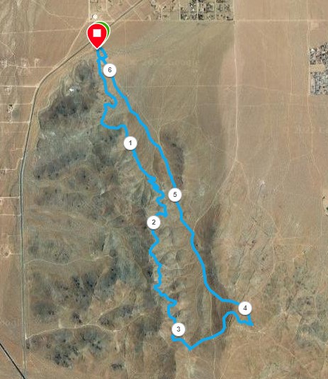
White Star Ridge Eureka Trail
This course starts and finishes at the Brady Trailhead. The mapped route is 6.2 miles, but there are more direct ways to descend from the trail's south end. To reach Brady Trailhead, head out South China Lake Blvd past Walmart and Albertson's, and pass the last houses on the left side of the highway. Look for a turnoff on the left side of the highway, near a large water tank on the right.
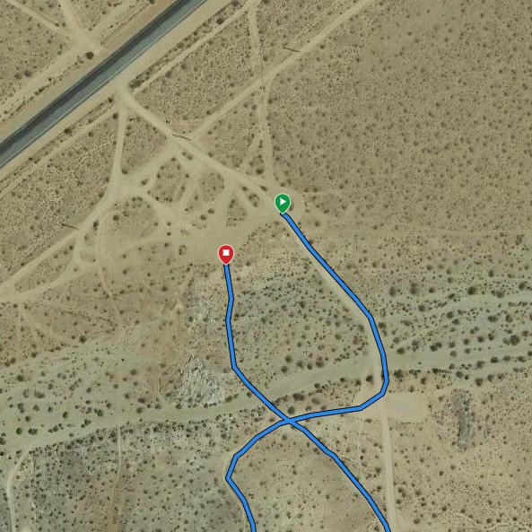
The mapped route starts from the Brady Trailhead main parking area, heading south on the main road. After crossing a wash, you will reach a point where there is a small parking area on each side of the road. Find the trail heading right from the right-side parking area. An alternate start is to find a southbound trail leaving the main parking area near a bench. Cross the wash and connect with the trail coming from the smaller parking area. Contour along the side of the ridge. Shortly after crossing a prominent wash, stay left at a trail junction (about .75 miles from the start) to continue gaining altitude on the east side of the ridge. At just after a mile from the start, you will encouter a couple of small switchbacks. Further on there is a second set of switchbacks. At the third right turn, at about 1.6 miles, find a trail heading to the left, to continue generally south. Right away cross a jeep road heading straight downhill--don't descend here. Finally, at about 3 and a quarter miles, the trail comes out on a road at a saddle. That is apparently the upper end of the Eureka trail, and you have a few choices for your descent.
The shortest option is to head straight downhill to the north on the dirt road crossing this saddle. The mapped route wanders east along a gentle ridge to cross a prominent southbound road (RC8). You could descend there. The mapped route continues east on a single track bike trail to the next main road going downhill (RC72). You could also continue on the ridgetop road until reaching RC72 at the next junction. Turn downhill on RC72, keeping left at a junction in a flatter area, at about 4 miles along the mapped route.
Continue downhill on RC72 until a junction at about 4.7 miles. By now, all of the optional descent routes mentioned will have merged onto RC72. Stay left here to follow RC72 up and over the saddle at the upper end of Lone Ridge. From there, continue on RC72 back to the trailhead. The mapped route follows a single track trail near the road on the left side.
If you want to avoid the climb to the Lone Ridge saddle, you can stay right at 4.7 miles, keeping to the east side of Lone Ridge and circling back around the nose of the Ridge to the Upper Lone Ridge Trailhead. Continue west to rejoin RC72. There are also some nice single track trails in the area north of Lone Ridge, on which you can make your way back to the trailhead.
You can view this route on Garmin Connect and either download a .gpx file or load it on your Garmin course-capable device.