Lone Ridge
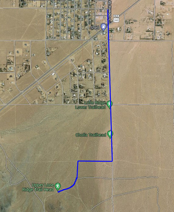
This course starts and finishes at the Upper Lone Ridge Trailhead. The basic distance is about 1.2 miles. There are many ways to extend the route, and a few are described here. To get to this trailhead, turn south off S. China Lake Blvd. at Downs, just before the Shell station. Continue past the end of the pavement, and the Lower Lone Ridge and Cholla trailheads. Turn right at the first good dirt road south of Cholla Trailhead, then left in another .2 miles. Stay right at a Y, heading toward the nose of the ridge. Parking at this trailhead is limited, so there is the option of parking at one of the lower trailheads and warming up in getting to the route start.
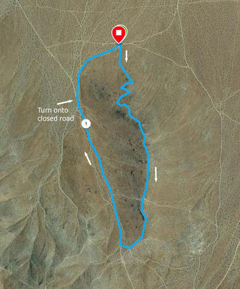
From the Lone Ridge Trailhead, start up the steep trail, then cruise along the top of the ridge until reaching the saddle at the upper end of Lone Ridge. From here, turn right to descend to the north on a well-traveled road (BLM signed RC72). As you near the nose of Lone Ridge, watch for a closed road branching to the right. Follow that road, staying right as you circle back to the trailhead. This route is shown in the image on the left, below. You can view the route on Garmin Connect and either download a .gpx file or load it on your Garmin course-capable device.
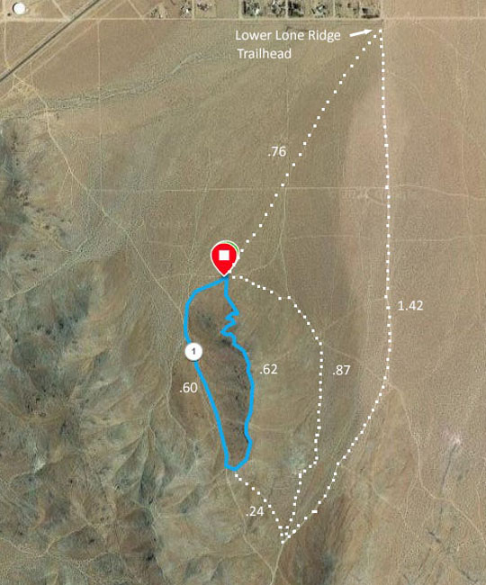
The image on the right shows a few ways to extend the distance after reaching the south end of Lone Ridge.