White Star Adventure 5K
Course Developer: Tony Scanlan
This run or hike begins and ends at the Brady Trailhead. The distance is about 3.1 miles and elevation gain is about 500 feet. It will take you to the western side of the ridge known as White Star Ridge. Do the course counter-clockwise.
To get to the trailhead, head out South China Lake Blvd past Walmart and Albertsons, and pass the last houses on the left side of the highway. Near a large water tank to the right of the highway, look for a turnoff on the left side.
The green buttons will take you to a Course page on Garmin Connect, or a Route on Strava or MapMyRun. If you need a .gpx file, you will be able to download that from any of these route pages. You can review the route navigation instructions here.
Course Description from Tony
The "Adventure" in the course name refers to a couple things. First, for a 5K, it's pretty challenging, and there's a lot of variation in the terrain, trails, roads, and views. Sometimes the course may even feel a little off-course! Second, although the general course area is not "remote" by any means, I think it will be new to many participants. In any case, all of the above is intentional. Hope you will have some fun along the way!
Look for the course start at the west/left side of the Brady trailhead dirt parking area. Begin by heading southwest about 200 feet to cross a wash and reach a dirt road heading up the hills which surround the White Star mine property. The climb is steep right off the bat, and you can expect about a 260 foot elevation gain within the first half-mile.
At about 0.3 miles, as you approach a huge 8-foot or so boulder, split off right from the road and onto the single track heading south along the ridge. The trail will gradually widen into a road, then at about 0.4 miles, you'll head up the steep, rocky incline to about the 0.5 mile point where the road tops out. After a quick breath, turn to the west and follow markings leading you over to a light single track trail running west along the ridge. Enjoy the view as you continue on the ridge for about 500 feet/0.1 mile. There, you will begin a quick, winding descent that will get you to the base of the hill and to about mile 0.9 on the course. Cross the road/wash there and continue on the light trail on the other side, heading south. For the next 0.4 miles or so, the course runs more or less parallel to China Lake Blvd/395, with traffic only about 100 yards away at times.
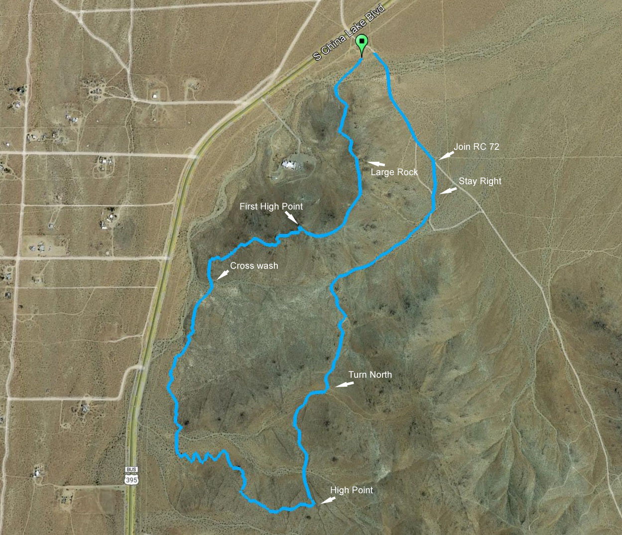
At about the 1.0 mile point, follow markings to merge onto a more established and trafficked bike trail. (As always, please be cautious of cyclists approaching silently at high speed when on bike trails.)
Continue south to about mile 1.3, where the trail makes a quick eastward turn, then splits three ways. Take the right-hand option here to continue heading south. The trail will dip a bit, and you will soon cross a dirt road to continue on the other side. About 200 feet from there, the trail will start to wind uphill in a general eastward direction. After about a 170-foot climb, you will reach the course high-point at about mile 1.8 (Good job!). Here, follow markings to make a sharp left off the trail and head downhill on an old dirt road. Watch your step here, as loose rock awaits to "help" you down. At the bottom, cross the intersecting dirt road, then pop back up the next "bump" on the other side, and continue to follow markings along the old road as it winds and rolls northward. At slightly over 2 miles, the course merges with another dirt road to head northeast, then at about 2.1 miles, it splits off again to the left to head north. In about another 200 feet from there, it's time to plan your finish. Start down the road, taking the right branch at the split about 180 feet out. Continuing down to the bottom(watch the rocks!), you will run into RC66--a much tamer dirt road--at about 2.3 miles. At this point, you can chose to pick up your pace, but don't let the next few road branches eject you off-course!
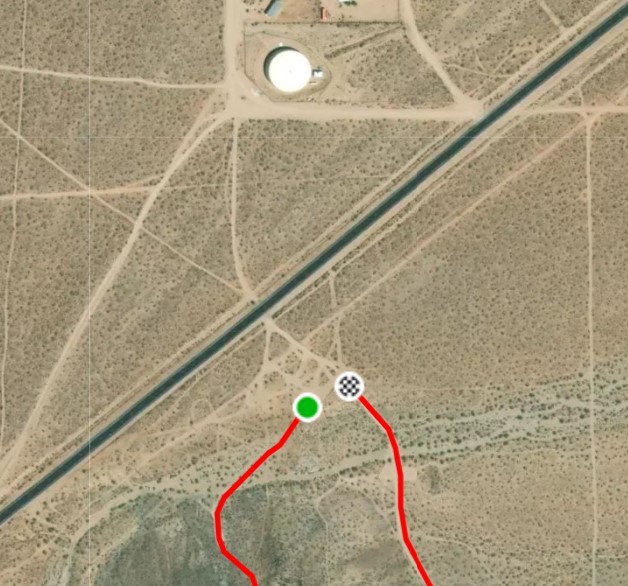
Continue on RC66 as it curves to the right and begins to head east. At about mile 2.6, take the left branch to split away from RC66. Continue around the curve to about mile 2.7, again taking the left branch at the split, to briefly join RC65. In about another 200 feet, take the right branch to leave RC65, then continue about 100 yards or so to join RC72/Brady. Continue north for about 0.3 miles on RC72, passing the small/lower parking area around mile 3, and following through to the Finish where RC72 just enters the east end of the Brady trailhead parking area (mile 3.1). Congratulations!