Firecracker 4000
This course has been an OTHTC in-person event on the 4th of July. Here's our chance to do a make up run! Start and finish are at the College Trailhead at the dirt parking area at the end of the pavement on College Heights Blvd.
The green buttons will take you to a Course page on Garmin Connect, or a Route on Strava or MapMyRun. If you need a .gpx file, you will be able to download that from any of these route pages. You can review the route navigation instructions here.
Course Description
Begin at the west edge of the parking area, and head out the straight road. At about .6 miles, take a sharp left onto RC4, going southeast.
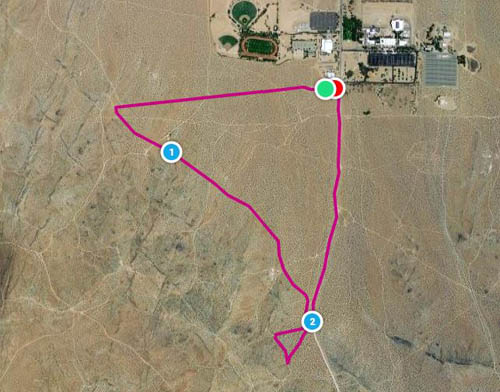
Just before reaching the main road -- extension of College Heights Blvd. -- look for a trail heading uphill. Turn right here. If you are familiar with the Caballo course, you are now following it in the counterclockwise direction.
Reaching a junction at about 1.8 miles, leave Caballo and turn downhill. Return to College Heights Blvd and coast downhill to finish at edge of the parking area.